 |
 |
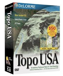
Topo USA® 5.0
Full U.S. Coverage on a Single DVD-ROM or 6 CDs
DVD Means No Switching Discs Every Time You Cross a
Small Geographic Area
Topo USA 5.0 gives you five maps in one – a
topographic map, a shaded relief map, a 3-D shaded
relief map, a trail map, and a road map. AND Topo USA
5.0 lets you route automatically for all of them!
Look at All You Can Do…
Type in the name of your favorite hiking, biking,
fishing, or hunting location (or better yet one that
you’ve been meaning to explore) – click -- you’re
there in seconds
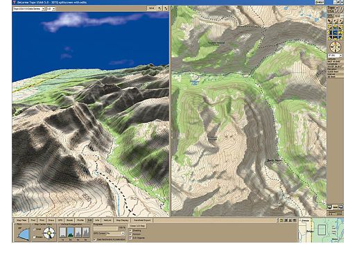
Gain a quick lay of the land with depth perspective of
contour intervals and shaded relief. Immediately
you’ll see the best place to go. One click sets a
start, one click the finish and just like that you
have an automatically generated route by trails,
roads, or straight across open ground. A complete GPS
waypoint track of your route is created and ready to
upload to your GPS receiver |
Click again and see an elevation profile of your
route that cross-references your position along the
route. Zoom in closer on the map, through dozens of
levels of detail, until you’re practically standing on
the trail
Press the 3-D tab and see terrain so realistically
you’ll feel like you’re there! Circle like a hawk over
the trail you’ve created. Adjust the pitch to see the
terrain from every angle.
Finally, print your 2-D and 3-D maps with route
profiles, your MapNotes, and Draw Objects choosing a map
scale that provides the detail you want
Things can change quickly in this world. Last trip’s
wilderness may now be a mountainside resort or a new
subdivision. Now, you can supplement your detailed Topo
USA 5.0 maps with aerial images – the types of imagery
even professionals have difficulty accessing.
DeLorme Aerial Data Packets (ADPs) include recent
10-meter satellite images, up-to-date aerial photos (DOQQs)
plus USGS 7.5-minute topo maps – all delivered in one
convenient download packet.
With DeLorme ADPs, you’ll see what awaits you:
-
Residential, agricultural, or commercial development
-
Land cover, forest density, clear-cuts
-
Radio towers, cemeteries, landing strips, buildings, and
more
-
Any roads or trails not included in the map data
Using the split-screen option, you can add any new
detail you discover on the imagery to the maps. Simply
trace or mark the new feature’s location and it will
automatically be drawn on the map, in a positionally
accurate manner.
With your purchase of Topo USA 5.0, you’re entitled to
download $50 worth of ADPs absolutely FREE. At over
12,000 acres, that’s a lot of destinations!
Don't pay retail prices! Contact us before you purchase.
|